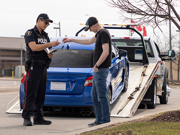
Traffic Safety Program
One of York Region’s top priorities is to reduce the number and severity of collisions that happen on Regional roads. The safety of all Regional roads and intersections is reviewed yearly. Based on the results, York Region can see which roads and intersections can be improved. The findings are then used to enforce the law, improve the design of new roads, make improvements to existing roads and intersections and raise public awareness.
Vulnerable Road User Safety Measures
At priority locations on Regional roads, York Region is focusing on implementing the following safety measures to protect the most vulnerable road users.
- Left turn signals
- Red light cameras
- No right turn on red restrictions
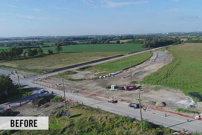
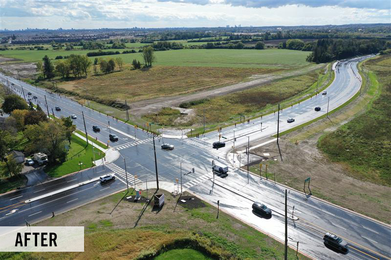
- Intersection improvements, such as new traffic signals
The safety measures outlined on this page support York Region’s Vision Zero Traveller Safety Plan, aiming to reduce severe collisions (those involving injury or death) by 10% over five years.
Learn more about our traffic safety measures and initiatives:
All way stops
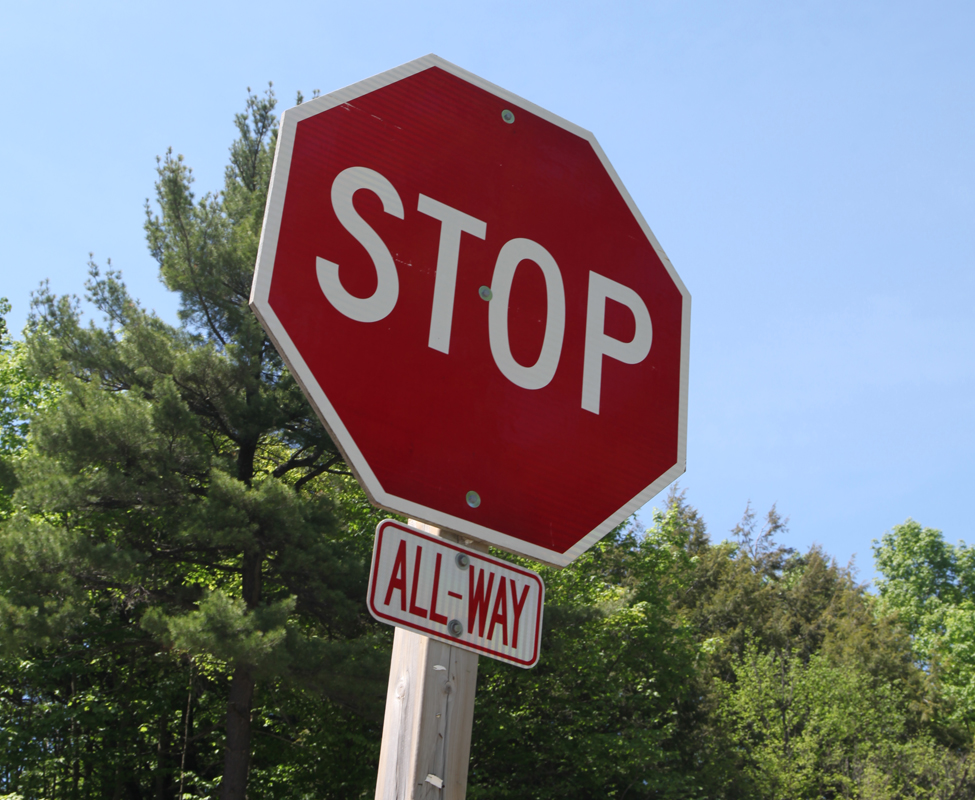
An all-way stop is an intersection where all vehicles must come to a complete stop, improving safety and clarifying right-of-way.
In 2025, a new four-way stop was installed at 14th Avenue and 11th Concession in the City of Markham. This safety measure helps reduce collisions, improve visibility and enhance the safety of all road users.
Impacts of safety measure
- Angle collisions decreased by 60% to 100%
- Turning collisions decreased by 50% to 100%
Digital no right turn on red sign
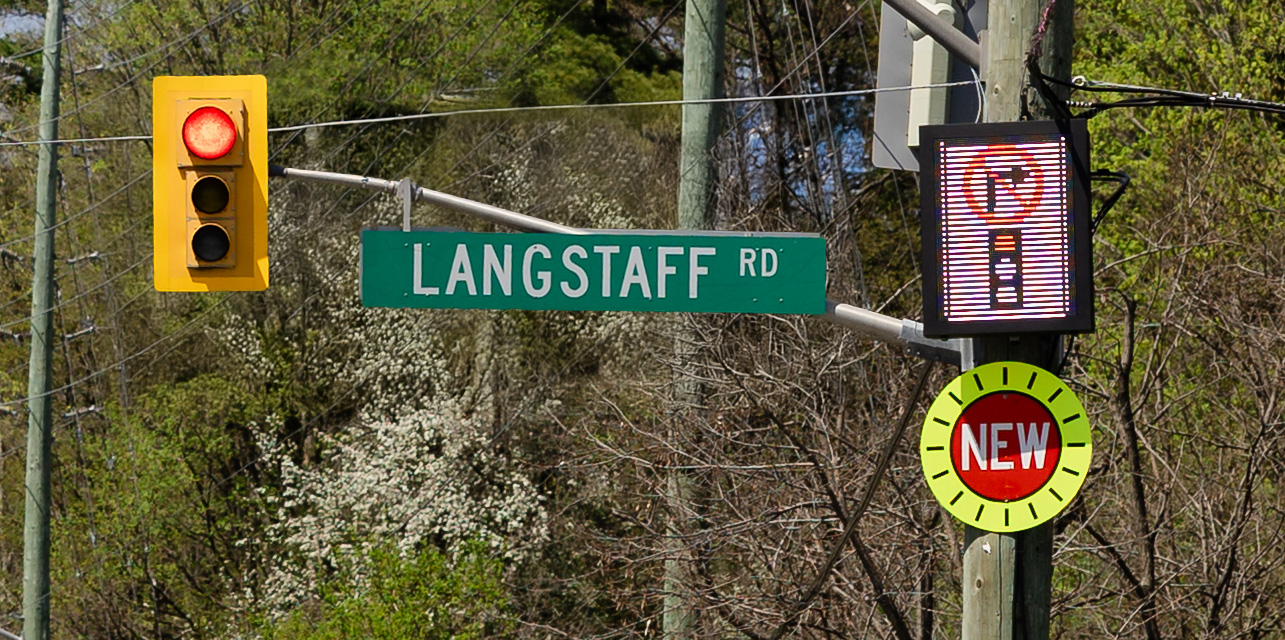
York Region piloted a new digital no right turn on red sign for six months at the intersection of Islington Avenue and Langstaff Road in the City of Vaughan for northbound travellers on Islington Avenue turning right onto Langstaff Road. The sign is the first one used in Ontario in this way. Following the success of the pilot, the Region will be replacing existing no right turn on red (NROR) static signs with digital no right turn on red signs at 50 locations in the next few years.
The no right on red feature is only activated when the push button is pressed and has many benefits, including:
- Increasing safety for pedestrians when crossing
- Enhancing visibility for motorists
- Reducing traffic delays and queue lengths
- Impacts of safety measure
- Over 99% compliance rate
- Reduction in delays and average queue lengths
Enhanced pavement markings in school zones
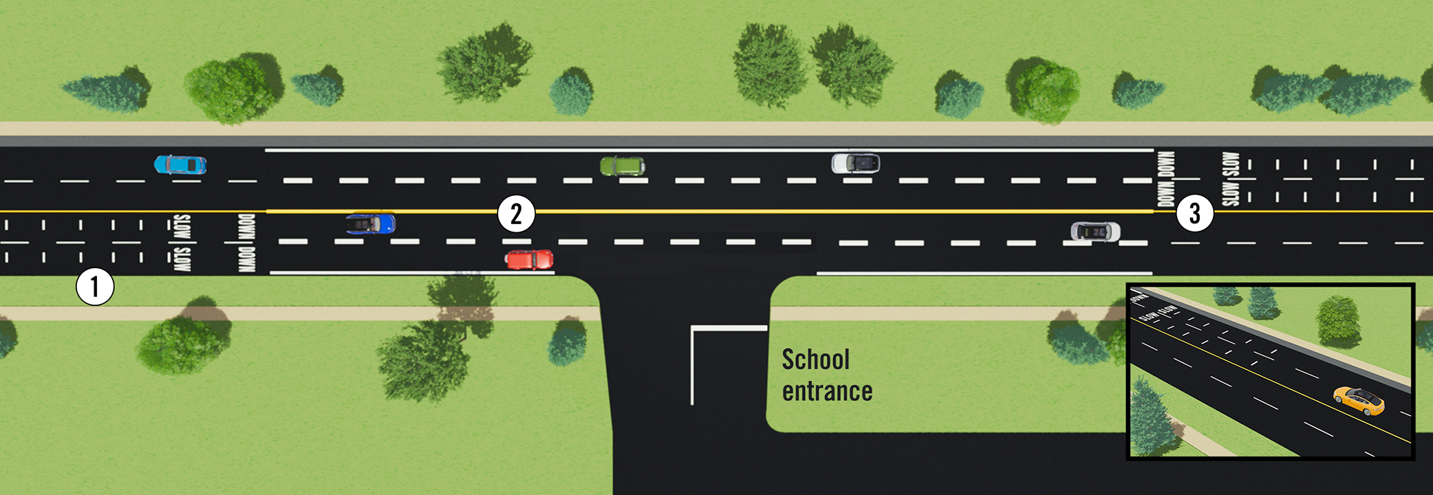
In June 2026, York Region is introducing enhanced pavement markings near Whitchurch Highlands Public School in the Town of Whitchurch-Stouffville to encourage drivers to slow down and improve school zone safety. New features include:
- Speed reduction markings (optical speed bars)
- Wider, more visible lanes
- Upgraded school zone pavement markings
Work will occur overnight to help minimize traffic disruptions. Access to the school will not be impacted.
These enhancements are part of a pilot project being introduced in nine school zones across the Region in 2026, with one school zone selected in each municipality. The pilot begins in the Town of Whitchurch-Stouffville at Whitchurch Highlands Public School. After implementation at the first location, a review process will take place and expand to the other eight locations. If successful, the program may be expanded to more school zones between 2027 and 2029.
This initiative supports York Region’s Vision Zero Traveller Safety Plan. The project is designed to encourage drivers to slow down and improve awareness around schools, helping keep students, families and all road users safe.
Gateway signs
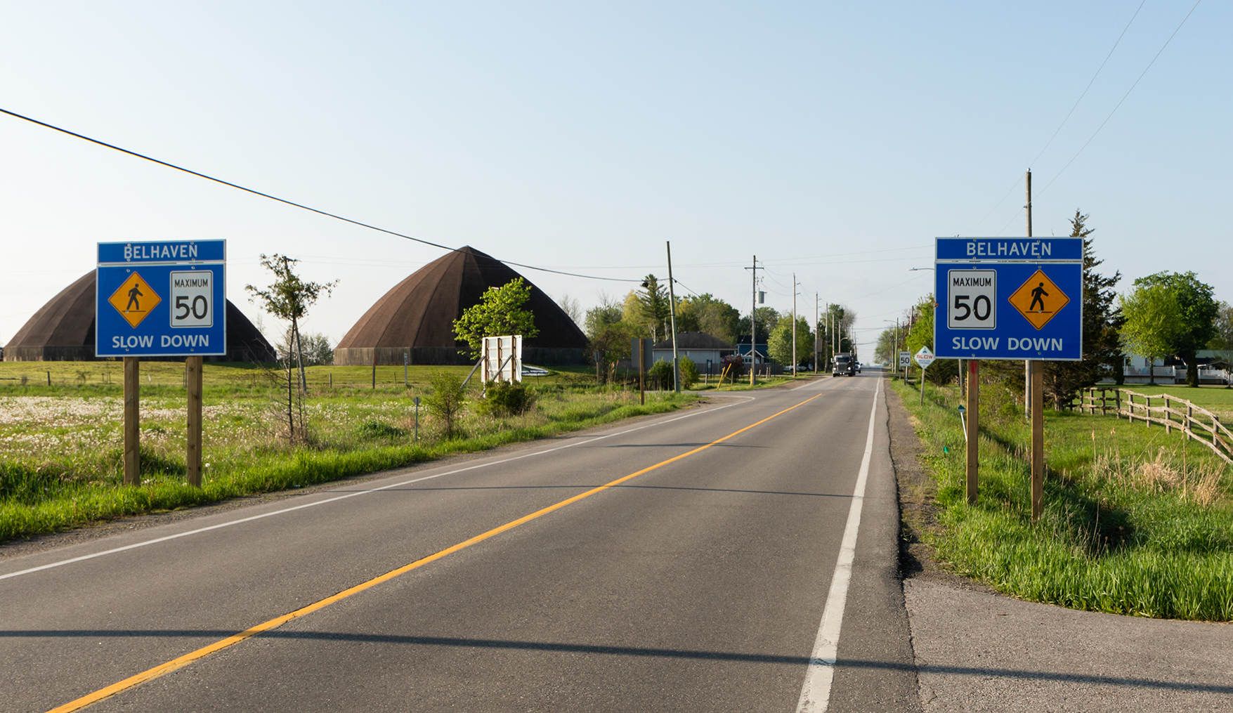
In rural communities, these pavement markings are paired with gateway signs displaying the community name, speed limit and pedestrian symbol, creating a visual narrowing effect that helps calm traffic.
2024/2025 Gateway Sign Locations
| Municipality | Road | Community name |
|---|---|---|
| East Gwillimbury | Mount Albert Road and McCowan Road | Holt |
| Georgina | Old Homestead Road and Warden Avenue | Belhaven |
| Georgina | Ravenshoe Road from Highway 48 to York Durham Line/Miles Road | Brown Hill |
| Georgina | Ravenshoe Road from Warden Avenue to Ravencrest Road | Ravenshoe |
| Georgina | Ravenshoe Road from Concession 6 to Lake Ridge Road | Udora |
| Georgina | Victoria Road from Minonen Road and Ravenshoe Road | Udora |
| Georgina | Warden Avenue from Bethel Sideroad and Old Homestead Road | Belhaven |
| Georgina | Kennedy Road and Metro Road North | Willow Beach |
| King | Dufferin Street Wellington Street West | Snowball |
| King | Wellington Street and Dufferin Street | Snowball |
| King | Weston Road from King Road to Laskay Lane | Laskay |
| Whitchurch-Stouffville | Ninth Line, north of Cedarvale Boulevard and south of Hillsdale Drive | Musselman's Lake |
| Whitchurch-Stouffville | McCowan Road from Bloomington Road to Bethesda Road | Lemonville |
| Whitchurch-Stouffville | Ninth Line and Bloomington Road | Bloomington |
| Whitchurch-Stouffville | Woodbine Avenue from Marjorie Drive to Vandorf Sideroad | Vandorf |
Impacts of safety measure
- Collisions reduced by up to 15%
- Speed reduced by about 5 km/h
Lane realignment
This safety measure changes the shape or direction of lanes to make intersections safer for all road users.
York Region realigned the intersection of Leslie Street and 19th Avenue in the City of Richmond Hill to improve safety and traffic flow.
Impacts of safety measure
- Collisions decreased by 32%
Left-turn signal
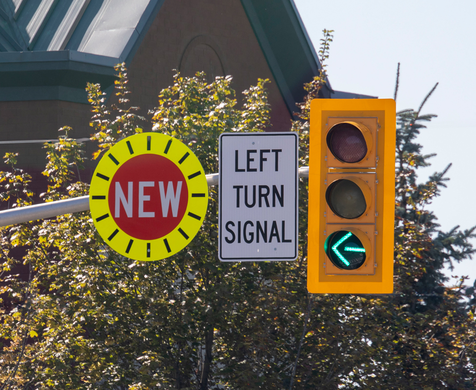
This safety measure permits left turns only when a green arrow is displayed to improve safety and reduce collisions. Opposing traffic and pedestrians crossing are not permitted. Collision statistics show that left-turning vehicles account for 36% of pedestrian collisions and 14% of cyclist collisions.
In August 2025, York Region installed new left turn signals at the intersection of St John’s Sideroad and Willow Farm Lane in the Town of Aurora to help reduce collisions and enhance the safety of all road users.
Impacts of safety measure
- Collisions reduced by 100%
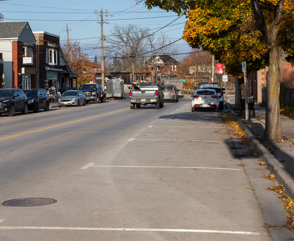
Line painting for street parking
Clearly marked parking spaces prevent blocked driveways, fire hydrants and transit stops. This measure helps improve sightlines and provides natural traffic calming.
Impacts of safety measure
- Collisions reduced by 100%
- Reduces speeds by 15-20%
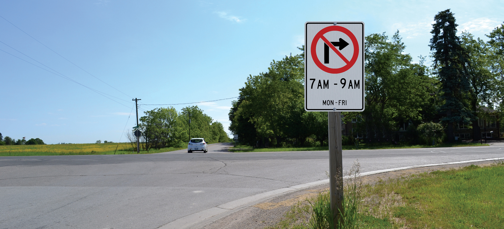
No right turn on red signal
This safety measure restricts right turns during red lights to protect pedestrians and cyclists.
York Region took positive steps in 2022 to increase safety for all road users at seven intersections in the City of Markham by implementing no right turns on red. Collision statistics show that right-turning vehicles account for 30% of pedestrian collisions and 50% of cyclist collisions.
Staff continue to study intersections where No Right Turn on Red (NROR) measures are implemented, to explore options to reduce delays for motorists while continuing to protect pedestrians and cyclists. Studies include observation and assessment of any road user concerns and offer further improvements.
Impacts of safety measure
- Collisions reduced by 75%
Pedestrian and cyclist pilot
York Region’s Pedestrian and Cyclist Safety Pilot aimed to improve safety for vulnerable road users at high-risk intersections by implementing targeted measures such as No Right Turn on Red, protected left turn signals, pedestrian head starts and additional warning signage. These measures were designed to reduce conflicts between vehicles and people walking or biking, particularly during turning movements. Using a data-driven approach, these safety enhancements were implemented at selected intersections identified as having the greatest potential to improve pedestrian and cyclist safety.
In 2025, an example of a targeted measure being implemented is a new digital no right turn on red sign at the intersection of Kennedy Road and Carlton Road in the City of Markham to increase traffic flow and safety for pedestrians and cyclists.
For more information on intersection improvements with new safety measures, visit york.ca/IntersectionSafety
Impacts of safety measure
- Collisions reduced by 60%
- Angle collision reduced by 75%
Pedestrian crossovers
Pedestrian crossovers are a type of traffic control in the Highway Traffic Act. They have specific signs and pavement markings, and some have push buttons and flashing lights.
Pedestrian crossovers provide pedestrians with crossing opportunities where there is demand and the location does not meet the provincial criteria for traffic signals. To be eligible for a pedestrian crossover, the location must have a speed limit of 60 km/h or lower, have lower traffic volume and no more than four lanes.
In 2024, we installed a new pedestrian crossover at Mount Albert Road, near Cupples Farm Lane/Royal Oak Road.
Impacts of safety measure
- Studies pending
Learn more about pedestrian crossovers by visiting york.ca/TrafficSignals
Red light cameras

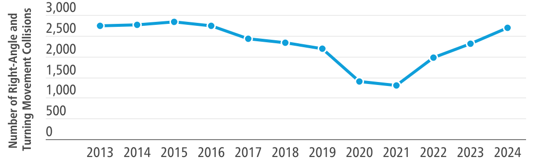
York Region wants to reduce the number and severity of right-angle collisions at intersections through its Red Light Camera (RLC) Enforcement Program, which focuses on improving driver and pedestrian safety. This initiative is part of the multi-year Vision Zero Traveller Safety Plan, with a goal to reduce severe collisions by 10% over five years.
Currently, York Region has red light cameras at 40 signalized intersections, with plans to add 15 more in 2025. RLCs are effective in reducing the number and severity of right-angle and turning movement collisions, two of the most severe collision impact types.
Impacts of safety measure
- Between 2013 and 2021, right-angle and turning movement collisions reduced by 53% at signalized intersections
- Between 2022-2024, following the pandemic, right-angle and turning movement collisions increased by 22.5% at signalized intersections, highlighting the need for additional RLCs. In response, York Region is installing 15 more in 2025
The figure below shows data between 2013 to 2024 on right-angle and turning movement collisions in York Region.
Learn more about red light cameras by visiting york.ca/RedLightCameras
Roundabouts
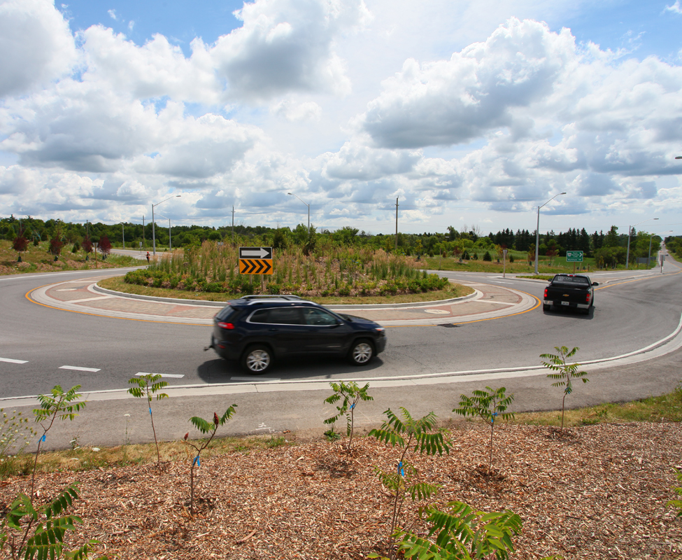
Roundabouts offer the benefits of continuous traffic flow, lower travel speeds and fewer collisions. They can cost less to operate and maintain and reduce emissions when compared to traffic signals. Traffic studies determine whether a roundabout or traffic signal is appropriate for an intersection.
York Region currently has two roundabouts, located at Lloydtown-Aurora Road and Keele Street in the Township of King and Ninth Line and Bayberry Street in the Town of Whitchurch-Stouffville.
As part of York Region’s Vision Zero Traveller Safety Plan, roundabout feasibility studies have been completed for eight possible roundabouts, which can improve traffic flow, increase pedestrian safety and cut collisions by up to 68%.
Impacts of safety measure
- Collisions decreased by 80%
- Injury/fatal collisions decreased by 88%
Learn more about roundabouts by visiting york.ca/Roundabouts
Senior zones
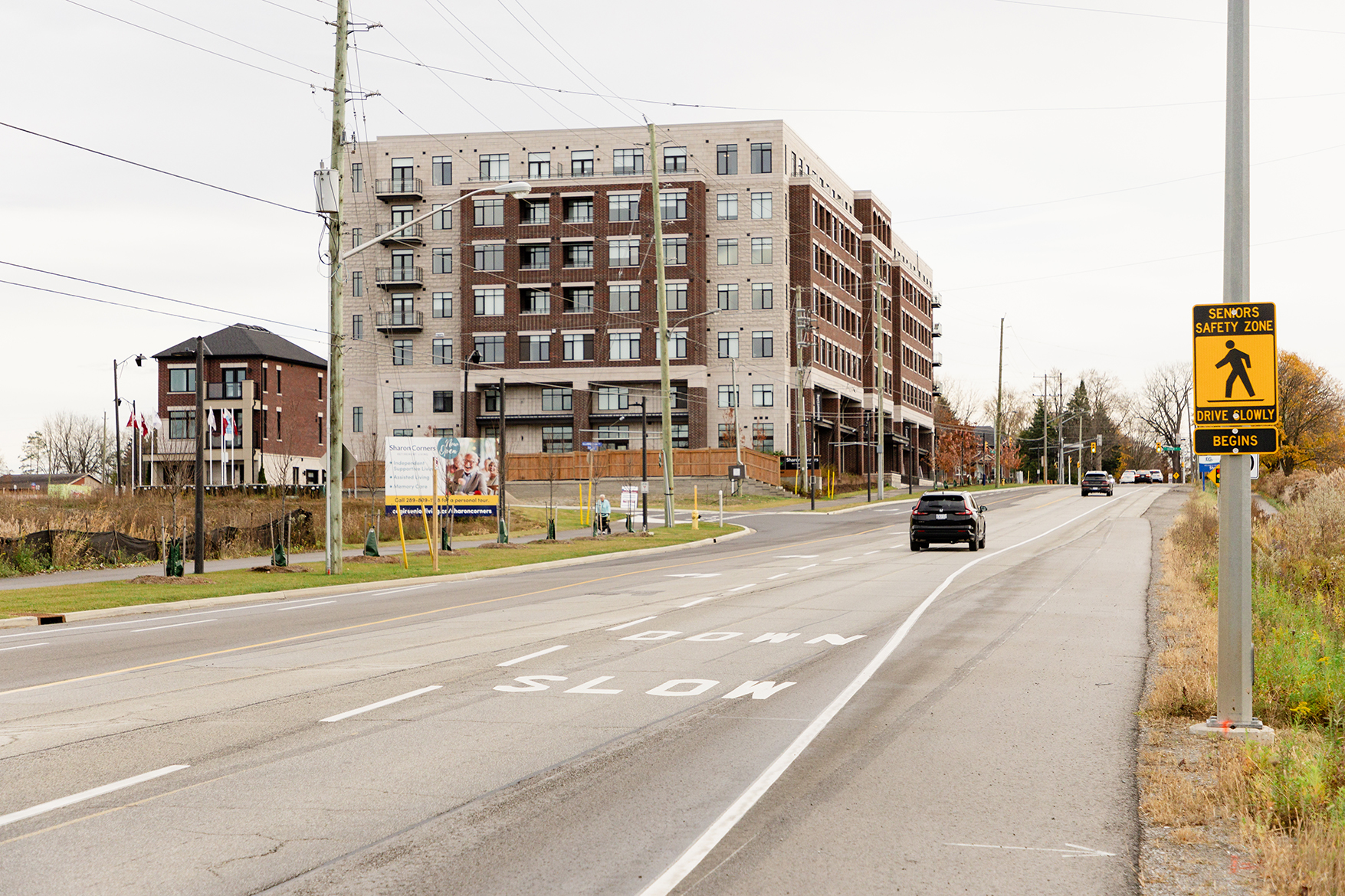
Senior Zones and Extended Walking Times at Signals were designated on 20 Regional roads near retirement homes and long-term care facilities. These zones include special signs warning drivers about seniors, large "SLOW DOWN" messages painted on the road and longer crossing times at nearby traffic lights to give seniors more time to cross safely.
An example of this safety measure is at Mount Albert Sideroad, east of Countryman Road in the Town of East Gwillimbury, which has helped reduced speeds in the area protecting vulnerable road users.
Impacts of safety measure
- Speeds reduced by 1 to 6 km/h in these areas
Slow down pavement markings
"Slow Down" pavement markings were added in all school zones to encourage lower driving speeds in high-risks areas. These large, easy-to-see messages painted on the road remind drivers to reduce their speed, especially in areas where children or seniors may be present.
The province sets the standards for how pavement markings should be displayed on the road. When you approach these markings, the vehicle in front of you might obscure part of the text. As a result, you will see "slow" until the vehicle moves, revealing "down." For more information on pavement markings, refer to the Ontario Travel Manual Book 11.
Impacts of safety measure
- Travel speed decreased 13% to 22%
- Speed limit compliance improved 15% to 48%
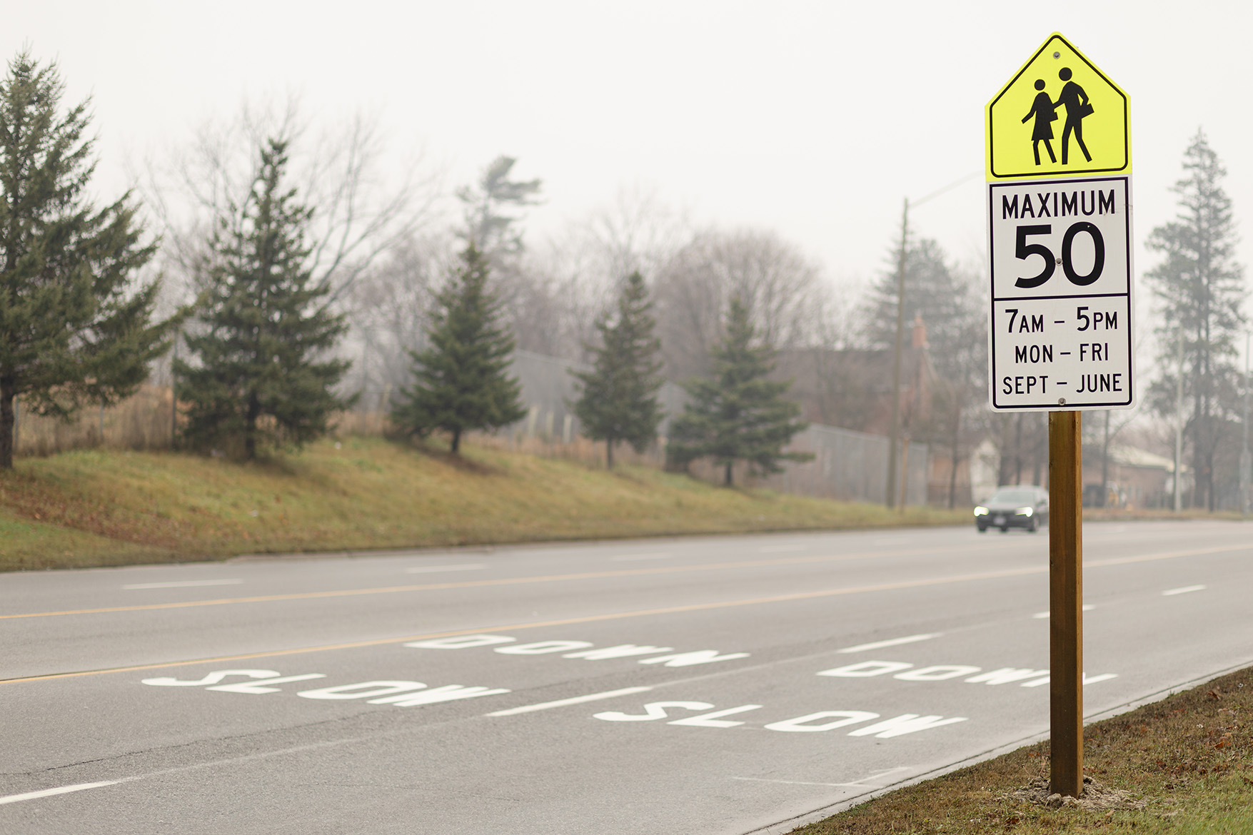
Speed limits in school zones
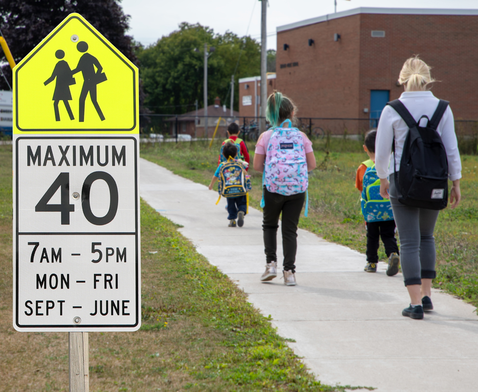
Speed limits are set for everyone’s safety and can vary based on road characteristics, volume and safety performance. York Region has speed limit reductions in place at more than 60 school zones across our nine cities and towns
From September to June, speed limits drop by 10 km/h in school zones from 7 a.m. to 5 p.m., Monday to Friday. Outside of school hours, the speed limit returns to 10 km/h higher.
Reducing speeds by 10km/h can make a big difference, giving drivers more time to brake and preventing serious injuries in the event of a collision.
Speed limits are set for everyone’s safety and can vary based on road characteristics, volume and safety performance. They remain in effect according to the regulatory signs present, regardless of holidays, Professional Activity (PA) days and the summer months.
Speed limit signs within and outside of school areas are installed in accordance with the Highway Traffic Act. The Region has installed several large school zone speed signs, community safety zones (fines increased) signs and slow down pavement markings to heighten awareness for motorists entering school areas.
In 2025, one location where speed limits have been reduced is on Highway 27 at Nashville Road near the Montessori School in Kleinburg to increase safety for pedestrians and children.
Impacts of this safety measure are assessed in combination with other safety measures outlined on this page.
Speed limit revisions
To keep pedestrians and cyclists safe, drivers need to take extra care and slow down, especially when travelling through school areas, residential areas and near playgrounds. York Region continues to identify strategies and measures to change driver behaviour and stop speeding.
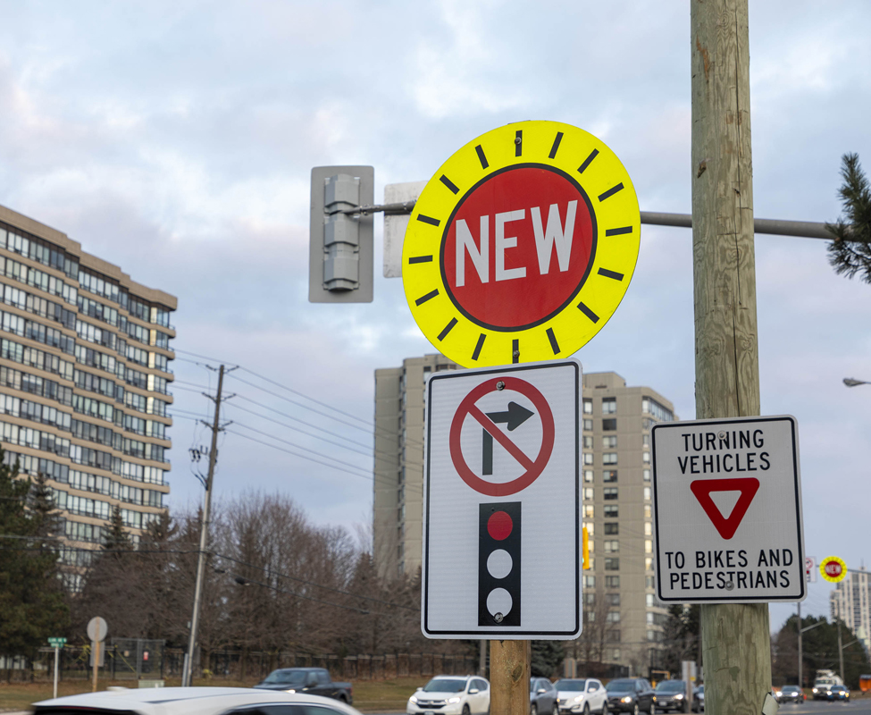
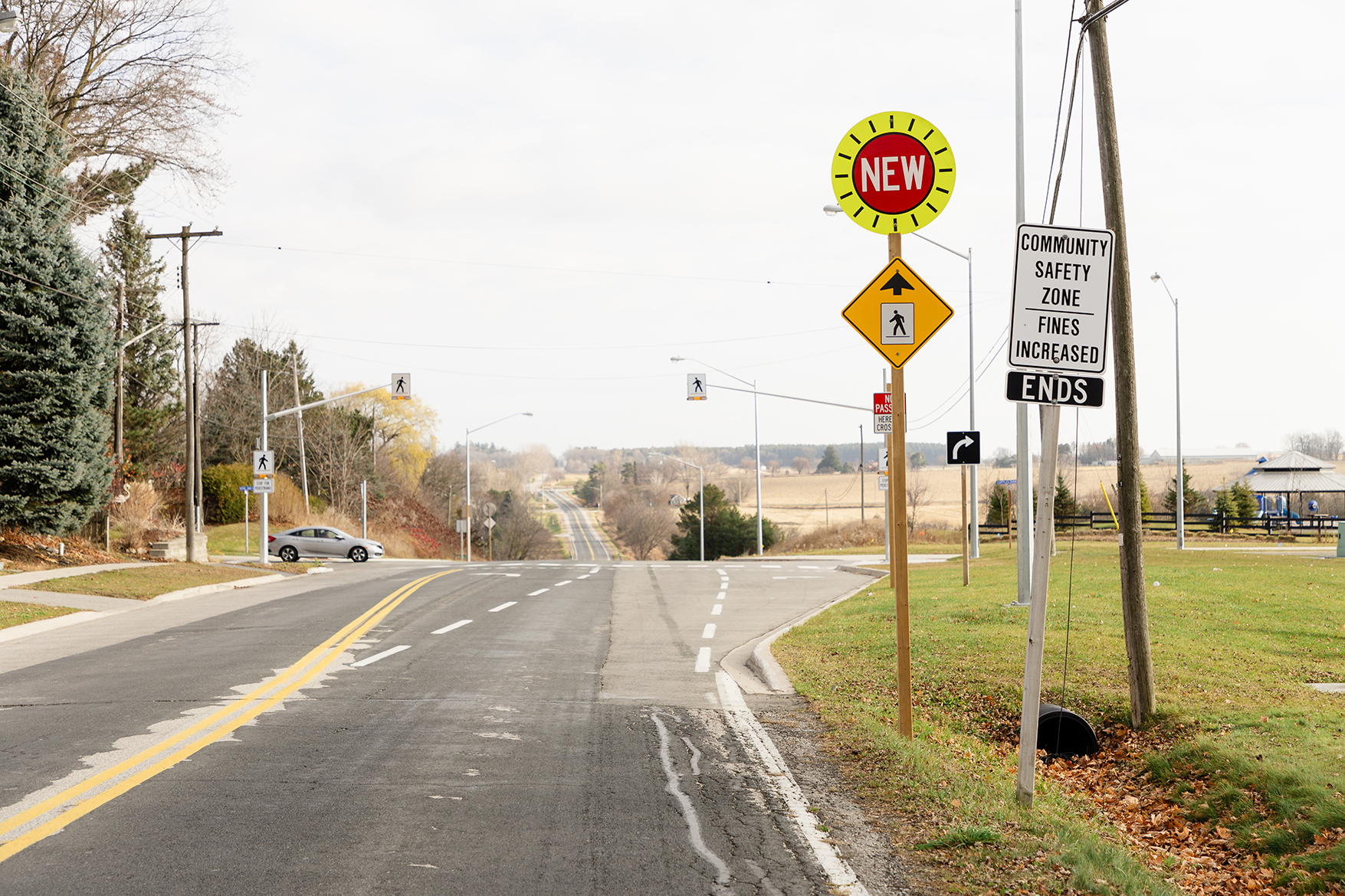
York Regional Council approved revisions to speed limits at seven locations on Regional roads. To notify travellers of the speed limit changes, speed limit signs are placed at the beginning of each changed speed zone, and for the first 60 to 90 days include a sign on the top with the word “NEW”.
For more information, visit york.ca/SlowDown
Speed monitoring boards
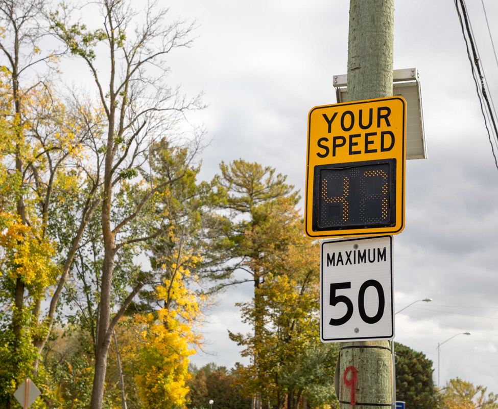
York Region places Speed Monitoring boards along Regional roads to monitor excessive speeding. These devices have been shown to increase compliance to the posted speed limit. The board measures the speed of passing vehicles and displays it as they pass. This encourages drivers to stay within the speed limit.
The speed of passing vehicles is stored and analyzed. If there is excessive speeding in the area, York Region will create a plan for speed limit enforcement.
Residents can report aggressive or dangerous driving by contacting York Regional Police directly through the following:
- Dialling 9-1-1 where unsafe traveller behaviour is an immediate danger to public safety
- Road Watch
- Report a Community Concern (also please see Community Safety Data Portal for further information)
To meet growing demands and support the safety of vulnerable road users, the Region is enhancing the program by installing 100 new radar speed boards over the next three years. They will be installed on a more permanent basis at priority locations to help promote lower operating speeds and improve road safety.
Impacts of safety measure
- Speeds decreased by about 5 km/h
- Speed limit compliance improved by 31% to 51%
Traffic signals
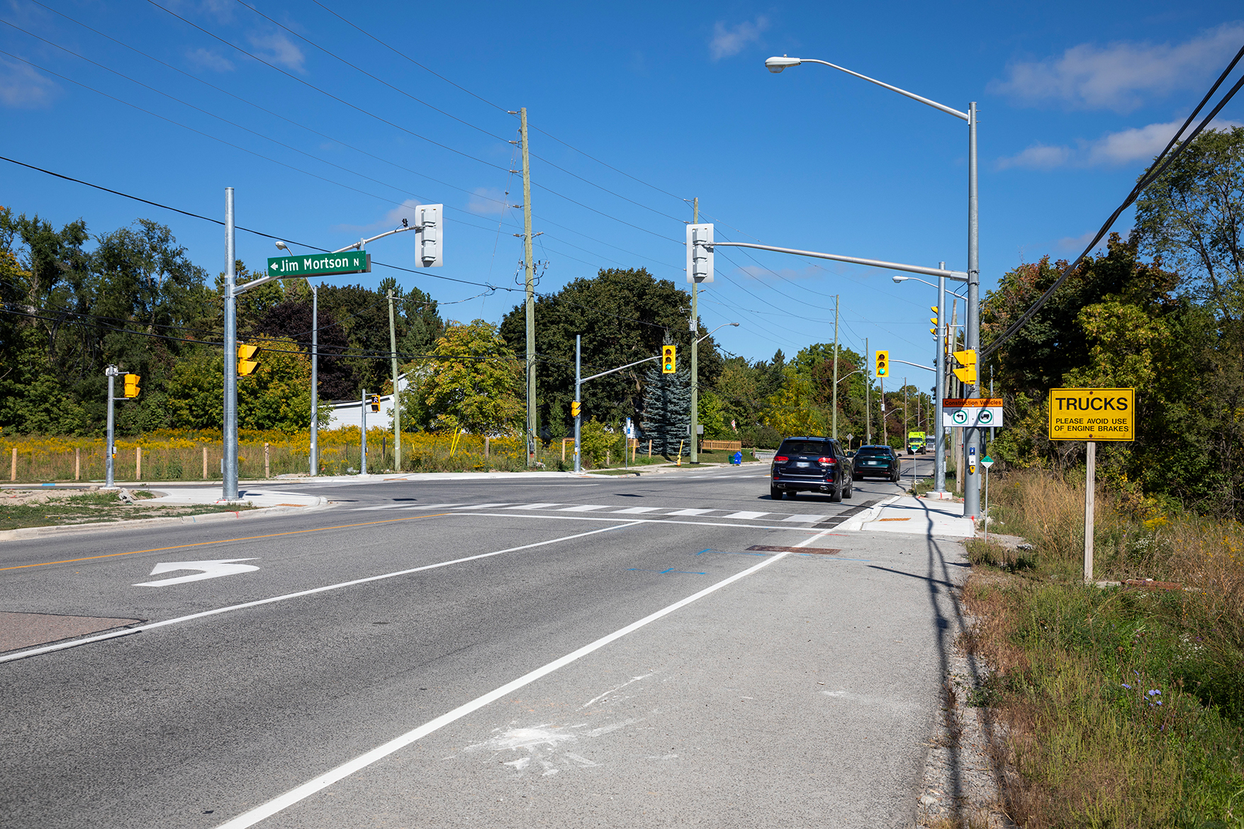
There are more than 2,000 intersections and nearly 900 traffic signals on Regional roads today. Adding a new traffic signal impacts a large transportation network and millions of travellers making important connections.
Most often, traffic signals are installed at the Region’s highly travelled intersections to manage heavier traffic by assigning the right-of-way to motorists, pedestrians, cyclists and public transit. Traffic signals may also be installed to address sightlines or other special conditions.
2025 New Traffic Signal Locations
| Municipality | Road |
|---|---|
| Aurora | St John’s Sideroad and Mavrinac Boulevard |
| East Gwillimbury | Leslie Street and Jim Mortson Drive |
| Georgina | Ravenshoe Road and Thornlodge Drive |
| Markham | Box Grove Bypass, north of Rizal Avenue |
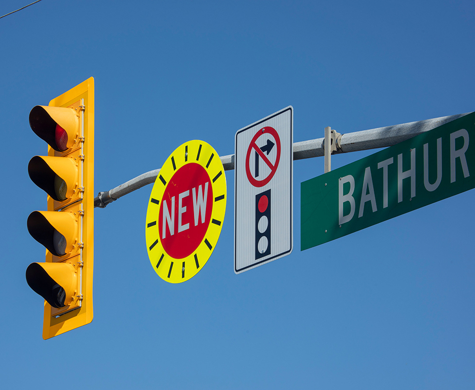
| Richmond Hill | Bathurst Street and Canyon Hill Avenue |
| Richmond Hill | Bathurst Street and Bethesda Sideroad |
| Vaughan | Dufferin Street and Eagles Landing Road |
| Vaughan | Major Mackenzie Drive and Thomas Cook Avenue |
Impacts of safety measure
- Collisions decreased by 17% to 100%
For more information on pedestrian and traffic signals, visit york.ca/TrafficSignals
Turn restrictions
This safety measure implements time-based turn restrictions to improve traffic flow and safety at intersections.
An example of this safety measure is the eastbound and southbound left turn restrictions implemented at Nashville Road and Cold Creek Road in the City of Vaughan in October 2025. These restrictions enhance safety for all road users at the intersection.
Impacts of safety measure
- Collisions reduced by 100%
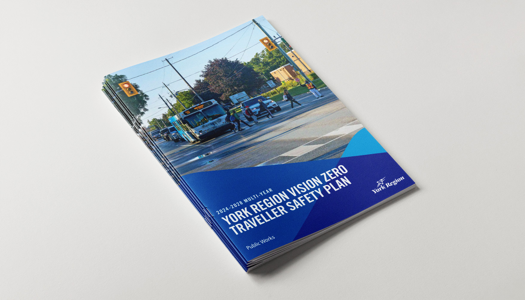
Plans and Reports
York Region has developed a multi-year Vision Zero Traveller Safety Plan 2024-2028 to help promote road safety. The Plan includes local and Regional roads and is led by industry professionals, consultants and road safety partners.
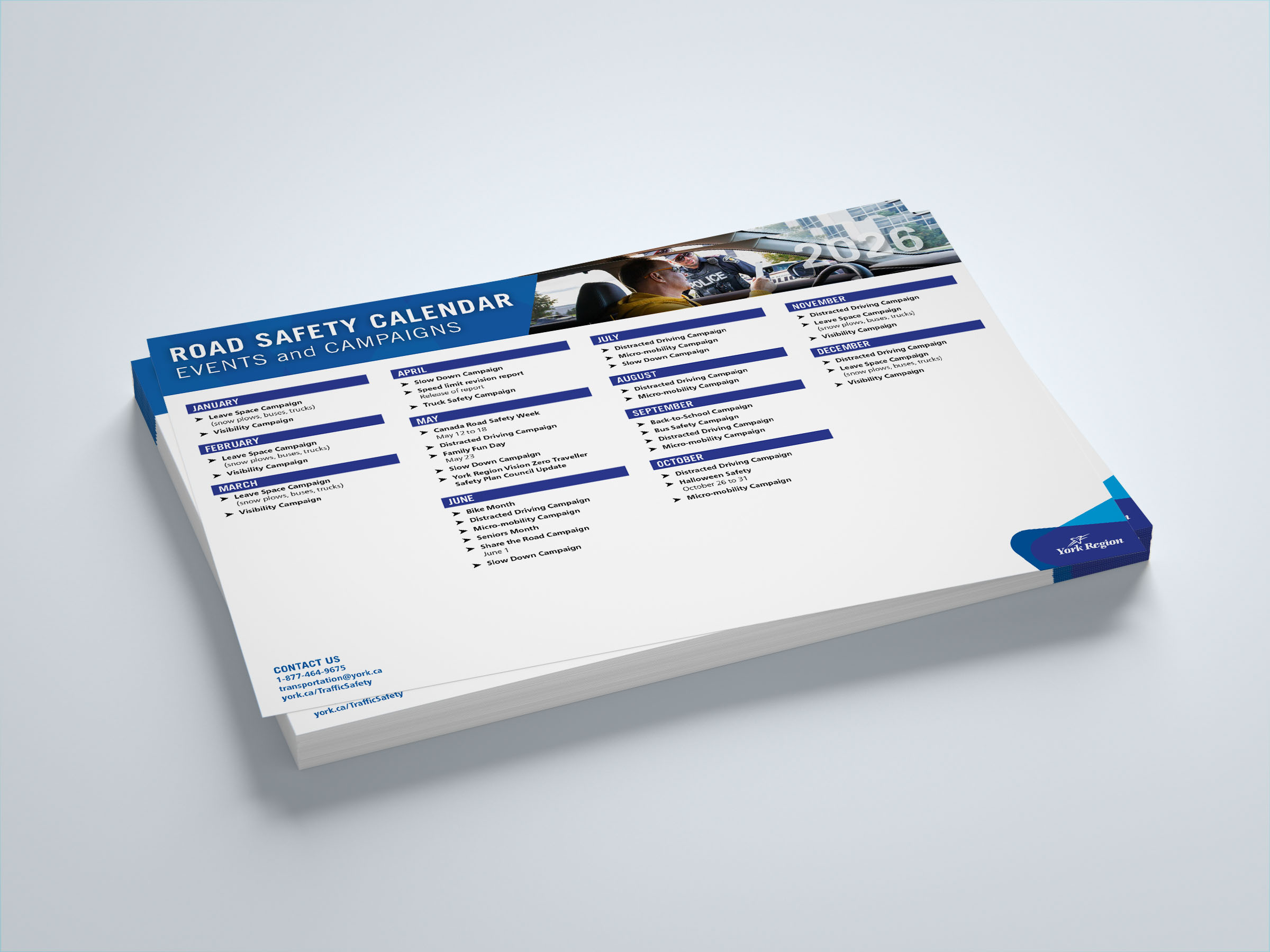
Road Safety Events and Campaigns
Events and Campaigns for 2026
January
February
March
April
- Slow Down Campaign
- Speed limit revision report - release of report
- Truck Safety Campaign
May
- Canada Road Safety Week - May 12 to 18
- Distracted Driving Campaign
- Family Fun Day - May 23
- Slow Down Campaign
- York Region Vision Zero Traveller Safety Plan Council Update
June
- Bike Month
- Distracted Driving Campaign
- Micro-mobility Campaign
- Seniors Month
- Share the Road Campaign - June 1
- Slow Down Campaign
July
- Distracted Driving Campaign
- Micro-mobility Campaign
- Slow Down Campaign
August
- Distracted Driving Campaign
- Micro-mobility Campaign
September
- Back-to-School Campaign
- Bus Safety Campaign
- Distracted Driving Campaign
- Micro-mobility Campaign
October
- Distracted Driving Campaign
- Halloween Safety - October 26 to 31
- Micro-mobility Campaign
November
December
Safety Tips
For motorists
Motorists play a very important role in keeping the streets safe. There are some simple things that motorists can do to make sure that they can see pedestrians when it is dark out and avoid collisions:
- Approach intersections with caution
- Make full stops at stop signs
- Keep windshields clean, both inside and out
- Adjust driving to the conditions of the road
- Keep windshield wipers in good repair
- Obey speed limits in school areas, school zones and community safety zones
Learn more about sharing the road with other road users, including pedestrians and cyclists, on the Ministry of Transportation's website.
Travelling through construction zones
Many construction workers are injured or killed each year when working on roads. When driving through construction zones motorists must:
- Slow down early when approaching construction zones
- Be patient and obey signs and signal persons
- Merge well in advance when lanes are being funnelled down
- Avoid lane changes, give yourself extra following space and be ready to stop
- Do not speed up quickly when leaving construction zones
- Do not pass construction vehicles when their amber lights are flashing
- Plan ahead and expect delays
For pedestrians
The clothing that pedestrians wear can play an important part in keeping them safe while walking, running or cycling. Pedestrians can make sure that motorists can see them at night by:
- Wearing reflective clothing
- Attaching a small flashing light to their clothing
- Only crossing the street at intersections and crosswalks
- Wearing light or bright colours instead of dark clothing
- Obeying all pedestrian signals
Travelling through construction zones
- It is very important to obey ALL work zone signs, workers and pavement markings
- Watch where you are going. Your primary responsibility is to walk through the work zone as safely as you can
- Orange Work Zone Signs – these signs communicate to drivers and pedestrians what is going on and how to travel safely through the work zone. They can also indicate that a sidewalk is closed and that a detour must be taken
- Pavement Markings –painted or taped lines on the pavement separate car travel lanes and can also indicate pedestrian walking paths
- During construction, some sidewalks may be closed. Pedestrians may be required to move to the other side of the road or to a temporary pedestrian walkway
- Use designated pedestrian crosswalks and traffic lights to cross the street before reaching a construction zone and DO NOT cross in the middle of the road
- Please DO NOT walk on the roadway beside the barriers
- Please be alert and aware of your surroundings when travelling near construction areas
For E-scooters and E-bikes
E-Bikes
Electric bikes (e-bikes) are becoming a popular way to get around York Region.
Know the rules of the road so you can ride safely:
- Wear a helmet
- Only ride where permitted
- Be visible
- Be courteous
Know the rules of the road
To operate an e-bike, you MUST be 16 years or older.
E-bike operators MUST follow the rules of the road under the Highway Traffic Act. The same rules as regular cyclists apply. There are fines for violations.
It is illegal to modify the electric motor of an e-bike to make it more powerful or increase its speed.
Wear a helmet
All e-bike riders MUST wear a CSA-approved bicycle or motorcycle helmet.
Only ride where permitted
Before planning your trip by e-bike, check with your local town, city or region for relevant bylaws as to where you can ride.
Be courteous
Always yield to pedestrians – slow on approach, ring bell or horn, pass on the left.
Use a bell to alert others that you are approaching.
Be visible
Wear reflective clothing. There are requirements for lights, a bell / horn, reflectors and reflective materials.
If you require a bike light or bell contact @email (while quantities last).
Resources
Bicycle safety: yrp.ca/bikesafety
Cycling maps and resources: york.ca/cycling
E-bike requirements and information: ontario.ca/transportation
E-Scooters
Electric kick-style scooters (e-scooters) are becoming a popular way to get around York Region.
Know the rules of the road so you can ride safely:
- Wear a helmet
- Only ride where permitted
- Be visible
- Be courteous
Know the rules of the road
To operate an e-scooter, you MUST be 16 years or older.
Passengers, cargo and baskets are NOT permitted.
E-scooter operators MUST follow the rules of the road under the Highway Traffic Act. The same rules as regular cyclists apply. There are fines for violations.
It is illegal to modify the motor of an e-scooter to make it more powerful or increase its speed.
Wear a helmet
All e-scooter riders under 18 years of age MUST wear a CSA-approved bicycle helmet. Helmets are recommended for all ages.
Only ride where permitted
Before planning your trip, check with your local town, city or region for relevant bylaws as to where you can ride.
Be visible
Wear reflective clothing and use reflective equipment. A front and back light, reflective tape, and a bell / horn are required.
Be courteous
Always yield to pedestrians – slow on approach, ring the bell or horn to alert that you are approaching, pass on the left. If you require a bike light or bell contact @email (while quantities last).
Resources
Bicycle safety: yrp.ca/bikesafety
Cycling maps and resources: york.ca/cycling
E-scooter pilot and requirements: ontario.ca/escooters
Safety Videos
For motorists
For pedestrians
For children
For teens
Related Resources
- York Region Traveller Safety Plan 2024-2028
- Be Visible. Be Seen.
- Intersection Safety
- Slow Down Campaign